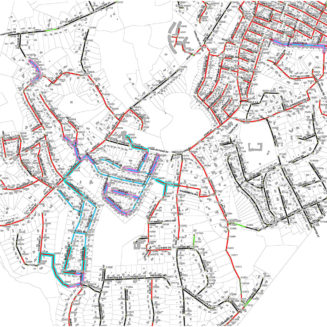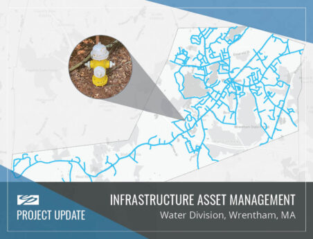
Water, Sewer & Drainage System Cataloging and Mapping
Geographic Information System (GIS) and mapping services are vital components of comprehensive water supply and distribution system master planning, wastewater facilities planning, and Phase II MS4 stormwater management projects.
Assisting municipalities in the areas of water, wastewater, and stormwater master planning, Environmental Partners (EP) has provided unique and timely services in the area of town-wide GIS and related system mapping. EP’s Asset Management team provides a wide breadth of services including providing a wide breadth of services including integrating GIS mapping with water distribution system hydraulic modeling; upgrading and conversion of assessor’s maps; digitizing scanned utilities plans; Water, Sewer and Drainage System Cataloging and Mapping; town-wide aerial mapping; and procurement and oversight.